The East Cliff Loop — Step by Step
A detailed walkthrough of Howth's most scenic route, complete with elevation changes, rest spots, and the best photo opportunities.

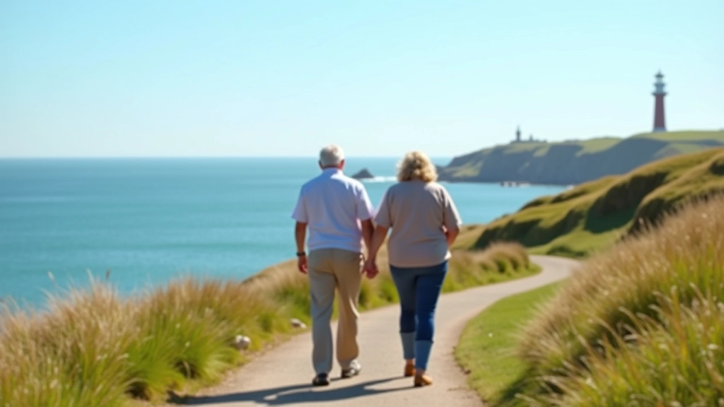
The East Cliff Loop isn't your typical seaside stroll. It's a proper walk with character — winding paths, genuine elevation changes, and views that shift with every bend. We're talking about the route that loops around Howth's eastern cliffs, starting from the pier and rising up through the coastal pathways before descending back down. Most people do it in about 90 minutes at a comfortable pace, though you'll want to build in time for photos and the inevitable moments when you just stop to breathe in the sea air.
What makes this loop special is the variety. You're not on one monotonous path. You'll walk harbour-side pavement, climb proper hill sections with handrails, traverse cliff-edge pathways, and discover small alcoves perfect for sitting. The route's been well-maintained for years, which matters when you're dealing with uneven coastal terrain.
Starting at the Pier — First 15 Minutes
You'll begin at Howth Harbour itself, where the tourist boats dock and the fishermen still land their catch. There's a wide promenade here — no climbing yet, just a pleasant walk with the water on one side and the village buildings on the other. It's flat enough that you can chat with a friend without breathing hard.
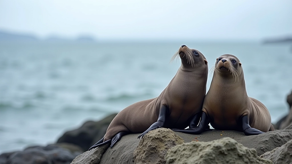
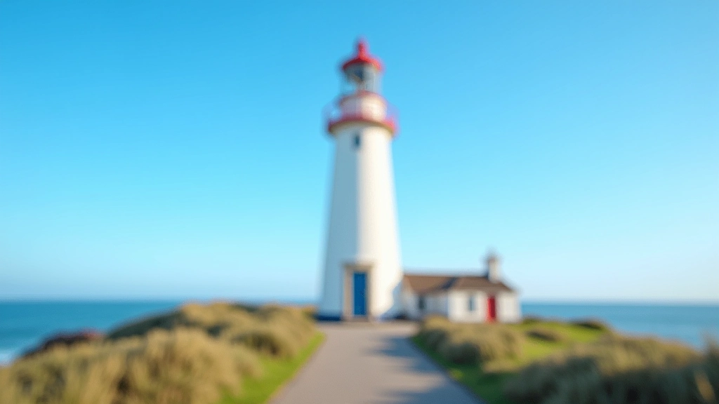
The first real landmark is the lighthouse. You'll walk right past it. The structure itself is smaller than you'd expect, painted in that classic red and white stripe pattern. Keep going along the harbour wall. This section is where you'll see the seals if you're lucky — they rest on the rocky outcrops just offshore. The water's usually calm here, so visibility's good on clear days.
By about the 15-minute mark, you'll reach the point where the path starts to slope upward. There's a bench here. Most people don't sit yet, but it's useful to know it's there for the return journey.
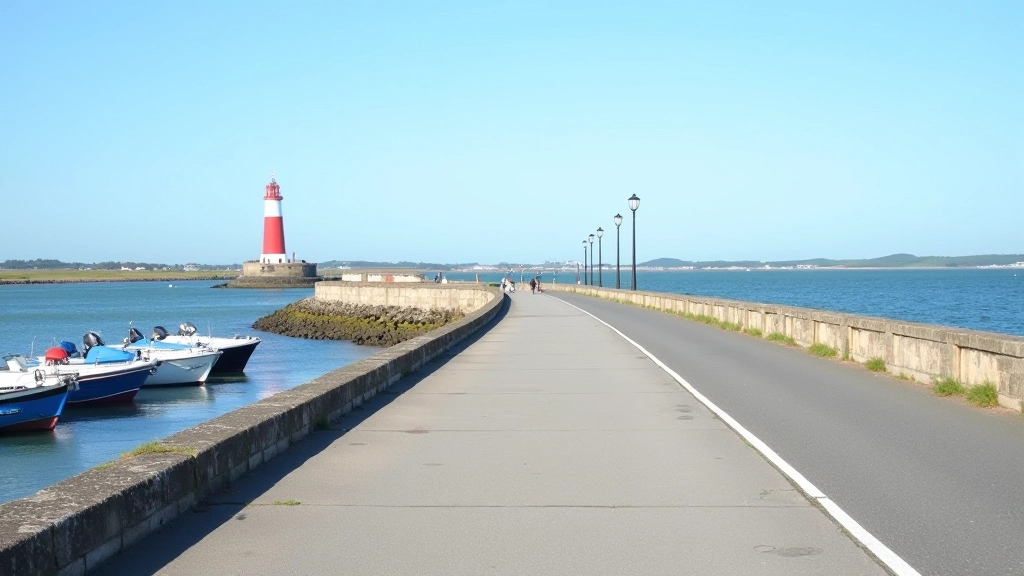
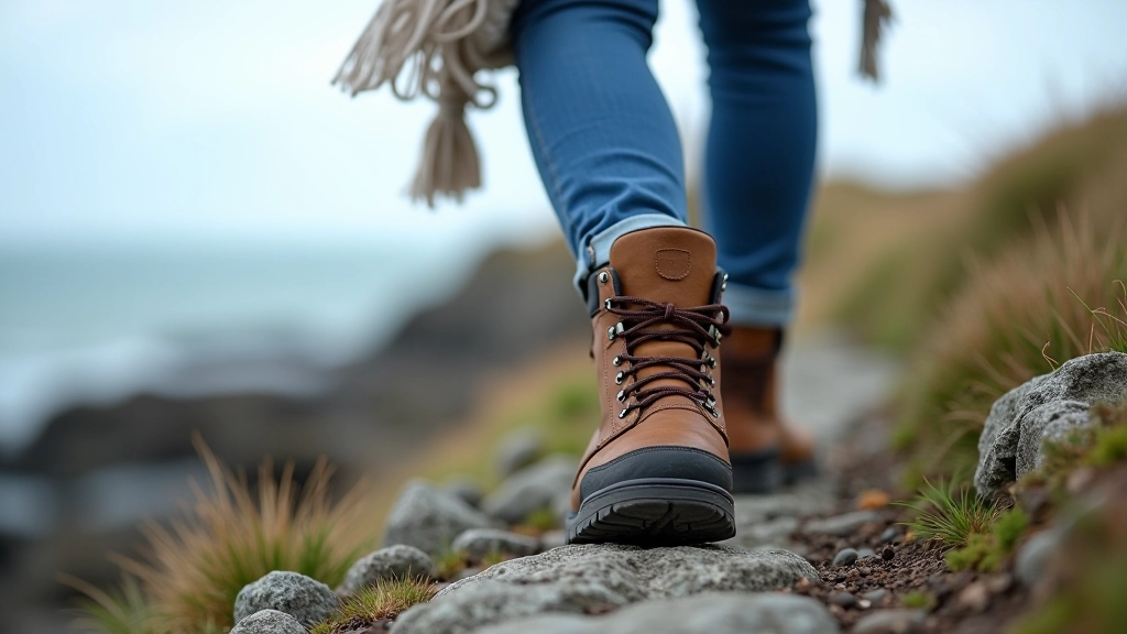
Tide Tip: The harbour wall can get slippery on the eastern side when the tide comes in. You're not in danger — the path's wide — but wear shoes with grip. The seaweed dries quickly in summer, so it's less of an issue June through August.
The Climb — 15 to 35 Minutes
This is where the loop gets interesting. The path angles up sharply. You're leaving the sea level behind and gaining about 60 metres of elevation over roughly 400 metres of path. It's not steep enough to be punishing, but it's definitely a climb.
There are handrails for most of this section — wooden ones installed specifically to help with the steeper bits. Don't skip using them. The path's well-trodden and clear, but when you're climbing with the ocean dropping away beside you, those handrails make a difference psychologically.
Around the 25-minute mark, you'll level out slightly. There's a flat section with a proper bench overlooking the sea. This is the official "halfway point" rest spot. You can see back down to the lighthouse from here, and across to the Dublin mountains on clear days. Most people take 5–10 minutes here to recover and hydrate.
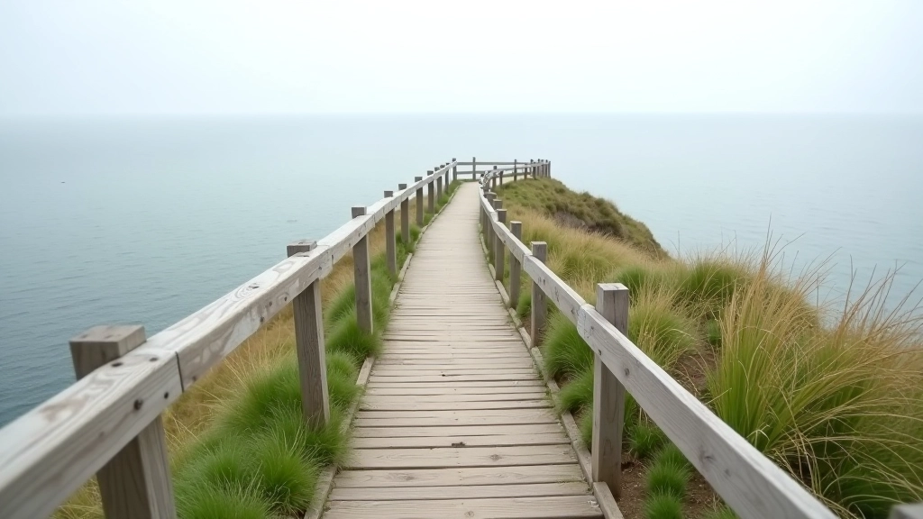
The Upper Cliff Edge — 35 to 60 Minutes
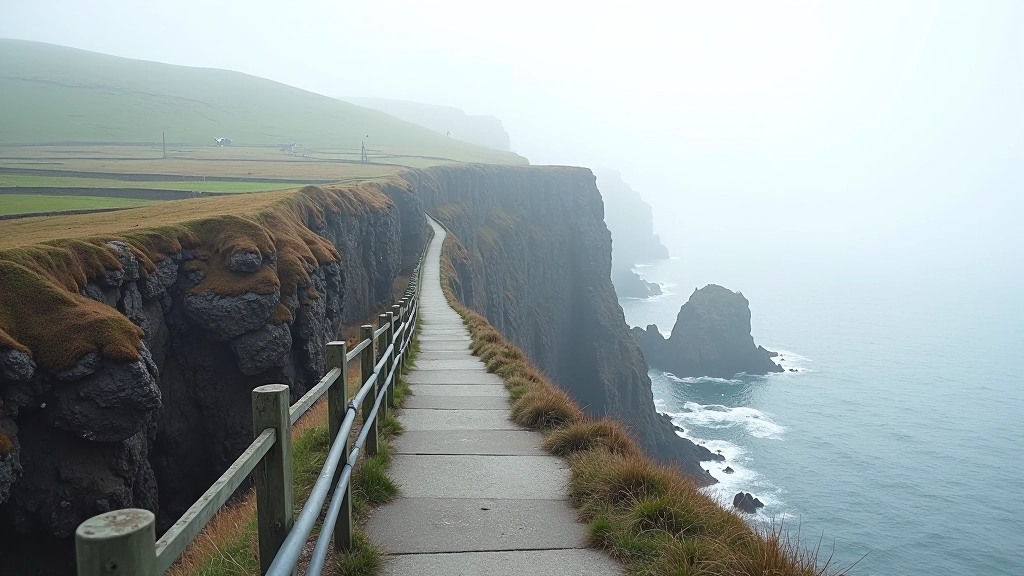
After the bench, you're walking along the cliff edge proper. The path here is narrower — maybe two metres wide — but it's fenced on the sea side. You won't fall off. What you will do is notice the drop more acutely. The cliffs themselves are about 50 metres down to the water. On windy days, you'll feel the breeze pushing up from below.
This section curves around the eastern edge of the headland. The rock face itself is worth looking at — you can see the geological layers, browns and greys stratified like a cake. Seabirds nest in these crevices. You'll see razorbills and guillemots if you're paying attention. They're not afraid of people, so you can get quite close with a camera.
The walking's easier here than the climb. You're gaining a tiny bit more elevation, but gradually. The path's been properly maintained with good drainage, so it's not muddy even after rain.
60m
Total elevation gain
2.5km
Loop distance
90min
Typical duration
The Descent — 60 to 85 Minutes
You'll reach the highest point of the loop around the 60-minute mark. It's marked by a small cairn and a final viewpoint. From here, the path starts downward. This is the easier half psychologically — gravity's helping you now.
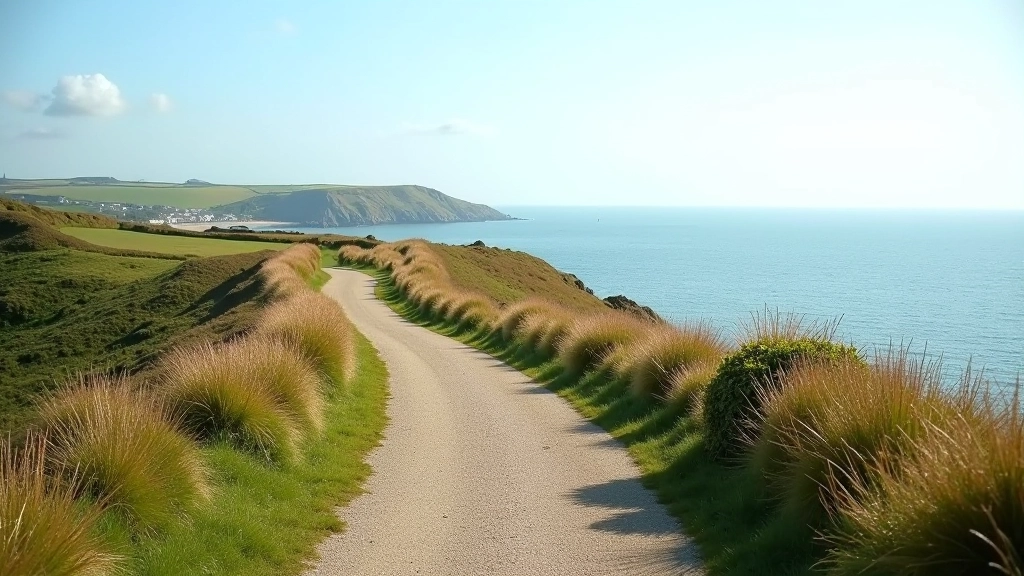
The descent curves back inland slightly, moving away from the cliff edge. You're walking through more open grassland, with the path clearly marked. There are fewer handrails here because the slope's gentler. Your knees will appreciate that if you've got any sensitivity on descents.
Around 75 minutes in, you'll drop back down to roughly sea level. The path widens again and becomes more urban in feel — you're back to walking past the backs of houses and small gardens. The final 10 minutes are straightforward. You'll recognise the buildings from the start, and then you're back at the harbour.
Important Information
This guide is informational based on typical conditions on the East Cliff Loop. Coastal weather can change rapidly. Check conditions before you go — wind and rain affect path safety significantly. Wear appropriate footwear with good grip. The route's suitable for most fitness levels, but if you have knee or balance concerns, consult your GP before attempting the climb sections. Mobile signal's patchy on the upper sections, so let someone know your expected return time.
What to Actually Expect
Don't expect a smooth, paved path the entire way. You're on a coastal route that's weathered by salt spray and wind. The handrails rust. The path gets uneven in places. The benches aren't always comfortable. That's not a criticism — that's authenticity. This loop's been walked for decades by locals who appreciate it exactly as it is.
You'll see the same views hundreds of people see every year, and they'll still feel fresh because the light changes everything. Morning walks are different from afternoon ones. Cloudy days reveal the cliffs' texture in ways that bright sun doesn't. The seals aren't always cooperative with your photography schedule.
The best time? June through September when the weather's most predictable and the light stays longer. Spring's good if you don't mind the wind. Winter's dramatic but honestly quite miserable unless you're the type who enjoys being blown about by Atlantic gales.
Bring water. Bring a camera if you want one. Wear layers because the wind at the top's always cooler than it looks from the bottom. Don't rush. The loop isn't going anywhere, and there's no prize for speed.